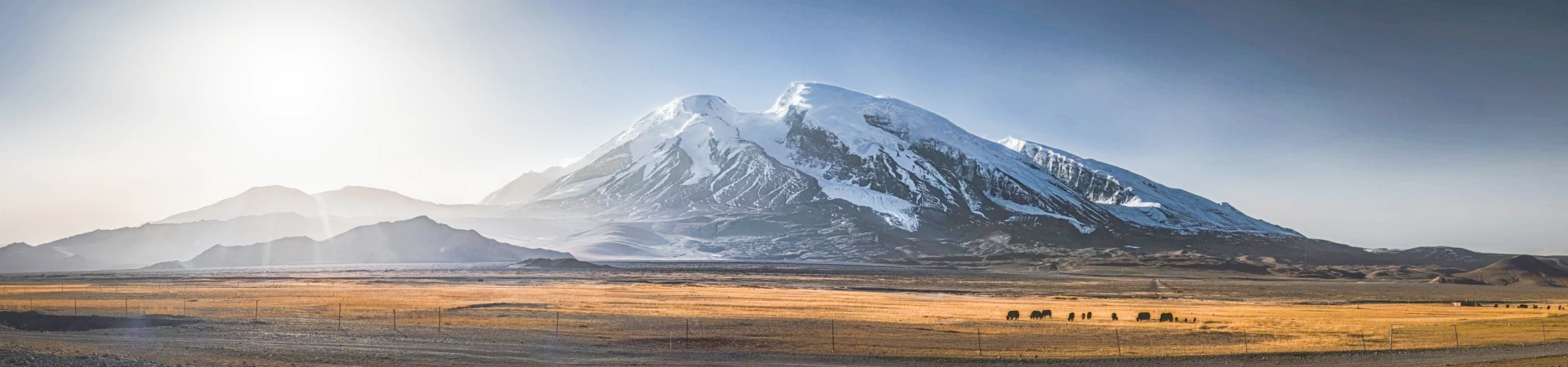
Muztagata Peak
Muztagh Ata, meaning "Ice Mountain Father" in Uyghur, dominates the Pamir Plateau in Xinjiang, China, with its 7,546-meter summit. As the third-highest peak in the Kunlun Mountains, it features over 90 glaciers, including the 8-kilometer-long Yangbulak Glacier, and serves as a hydrological hub for the Tarim Basin. Designated a national geological park, it merges extreme mountaineering with Silk Road heritage, attracting climbers and geologists alike.
Historical Overview
- Early Exploration: First documented by British explorer John Wood in 1838, later studied by Russian and Swedish teams in the late 19th century.
- First Ascent: Achieved in 1956 by a Chinese-Soviet joint expedition via the west ridge, establishing the standard route.
- Notable Events: Eric Shipton and Bill Tilman's 1947 attempt reached 7,000 meters; the 1959 Chinese expedition set a women's altitude record.
- Modern Era: Popularized as a training ground for 8,000-meter peaks, with commercial climbing tours operating since the 2000s.
Structural Layout
The mountain is divided into three zones:
- Glacial Zone: Features 93 glaciers, including the Yangbulak Glacier, with ice thickness up to 300 meters.
- Alpine Zone: Rocky outcrops and moraines between 4,500–6,500 meters, including the traditional west ridge climbing route.
- Subalpine Zone: Karakul Lake (3,600 meters) and surrounding grasslands, offering base camp facilities.
Key structures include the Karakul Lake Visitor Center and designated camping areas.
Major Attractions
- Yangbulak Glacier: A UNESCO-recognized ice formation with crevasses and seracs, ideal for glaciology studies.
- Karakul Lake: A turquoise high-altitude lake reflecting Muztagh Ata's summit, popular for sunrise photography.
- West Ridge Route: The standard climbing path with 25–30° slopes, suitable for intermediate mountaineers.
- Skiing Descent: A 2,500-meter ski run from the summit, popular among European adventurers.
- Subash Valley: A cultural corridor with ancient Silk Road relics and Tajik villages.
Suggested Itineraries
- Classic Route (3 Days):
- Day 1: Kashgar → Karakul Lake (base camp at 3,600m).
- Day 2: Acclimatization hike to 4,500m.
- Day 3: Summit attempt (7,546m) and descent.
Highlights: Glacier views, Tajik cultural encounters.
- Skiing Expedition (7 Days):
- Days 1–2: Kashgar → base camp.
- Days 3–5: Ski training on Yangbulak Glacier.
- Day 6: Summit climb and ski descent.
- Day 7: Return to Kashgar.
Highlights: High-altitude skiing, professional guide support.
- Cultural & Scenic Tour (5 Days):
- Day 1: Kashgar Old City tour.
- Day 2: Drive to Karakul Lake, visit Tajik yurts.
- Day 3: Hike to Kongur Tagh viewpoints.
- Day 4: Explore Subash Valley ruins.
- Day 5: Return to Kashgar via Oytagh Glacier.
Highlights: Silk Road history, local nomadic culture.
Ticket Purchase
- Online: Book via the official Xinjiang Tourism Bureau website or platforms like Ctrip.
- On-Site: Tickets available at Karakul Lake entrance (¥120 adults, ¥60 students; 2025 prices).
- Packages:
- Climbing Permit: ¥36,800 (includes guide, equipment, and insurance).
- Cultural Tour Bundle: ¥2,500 (transport, accommodation, and guided hikes).
- Free: Children under 1.2m, disabled visitors.
Transportation
- By Car: Private transfer from Kashgar (215 km, 4 hours via G314 Highway).
- By Bus: Daily buses from Kashgar South Station to Karakul Lake (¥50, 5 hours).
- By Taxi: Direct ride from Kashgar Airport (¥600, 4 hours).
- Local Transport: Shuttle buses from Karakul Lake to base camp (¥30, 1 hour).
Best Time & Tips
- Peak Season: June–August (optimal climbing weather; 70% success rate).
- Avoid Crowds: Visit in September for autumn colors and fewer tourists.
- Essentials:
- Acclimatize in Kashgar (1,300m) before ascending.
- Carry sunscreen, polarized sunglasses, and a -20°C sleeping bag.
- Hire a local guide for glacier navigation (¥500/day).
- Prohibited: Unauthorized solo climbs, drone flights without permits.


Contact Us
What Our Clients Say?
Based on 10,000+ traveler reviews

Daniel Dorothea
Canada
Reviewed on April 29,2025
Shopping on Nanjing Road in Shanghai was just amazing! It's truly the "First Commercial Street of China", where tradition and modernity blend perfectly. You can find awesome souvenirs and experience the trendy vibes in cool stores. The neon lights at night are just spectacular, shining bright like Times Square in New York. The food here is incredible too. I had a feast for my taste buds. Shanghai, I'll definitely be back!
Destination(s):
Shanghai
Date of
Experience:
May 08,2024


Elvis Eva
Canada
Reviewed on June 20,2025
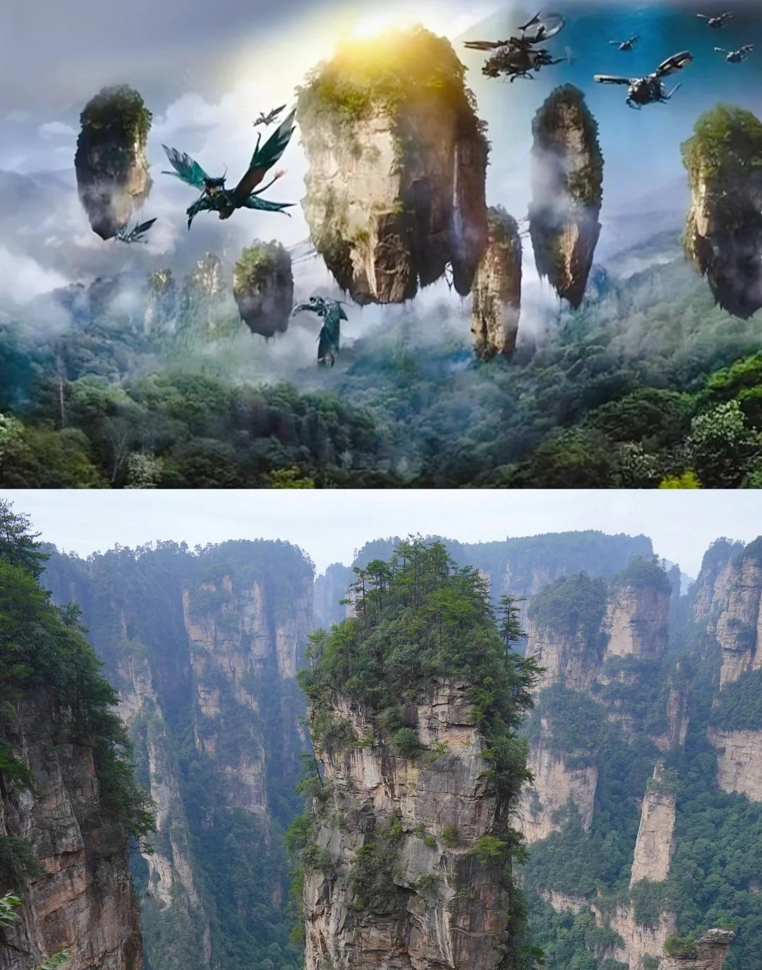
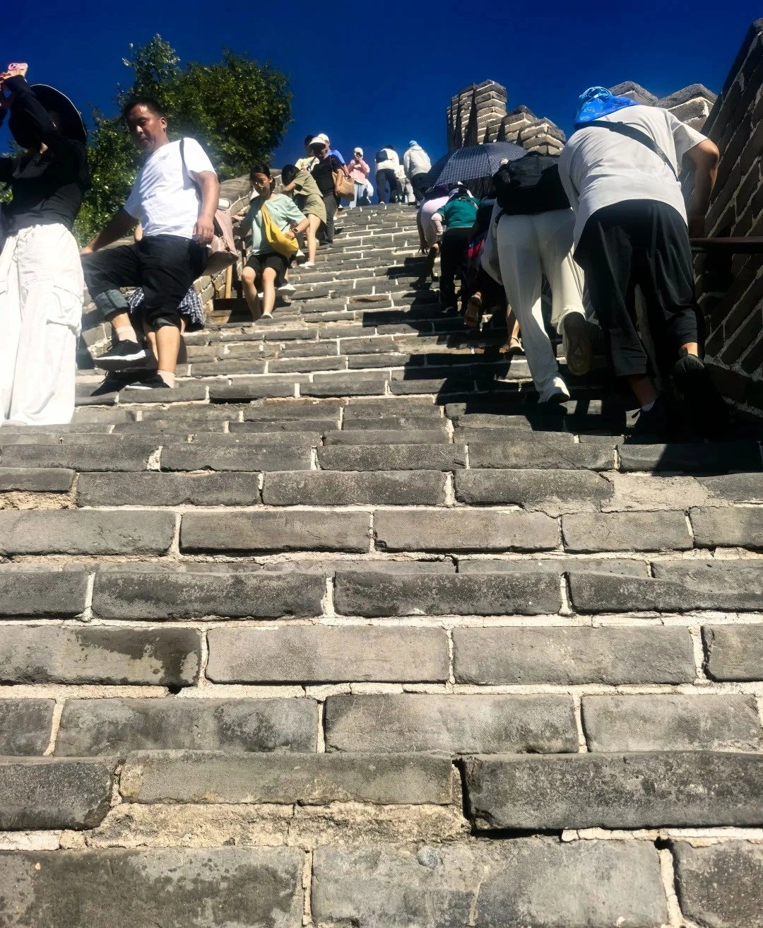
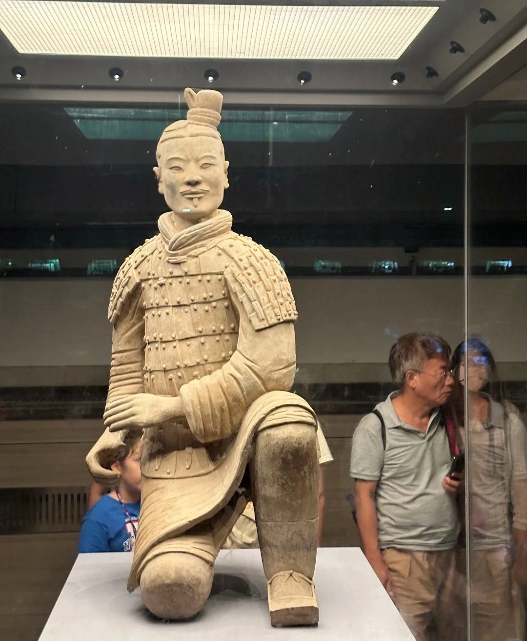
As a solo traveler from Canada, I was nervous about navigating China alone—but this 11-day tour was PERFECT! From hiking the Great Wall at sunrise (Day 3) to gasping at the Terracotta Army (Day 5), every day delivered ‘pinch-me’ moments. The real showstopper? Zhangjiajie’s Avatar Mountains (Day 7)! Our guide made the stone pillars come alive with stories.
Massive thanks for handling all logistics—bullet train tickets, entry passes, car! And the 4-star hotels surprised me.
Destination(s):
Beijing Xian Zhangjiajie Shanghai
Date of
Experience:
June 02,2025

Simon
America
Reviewed on May 29,2025
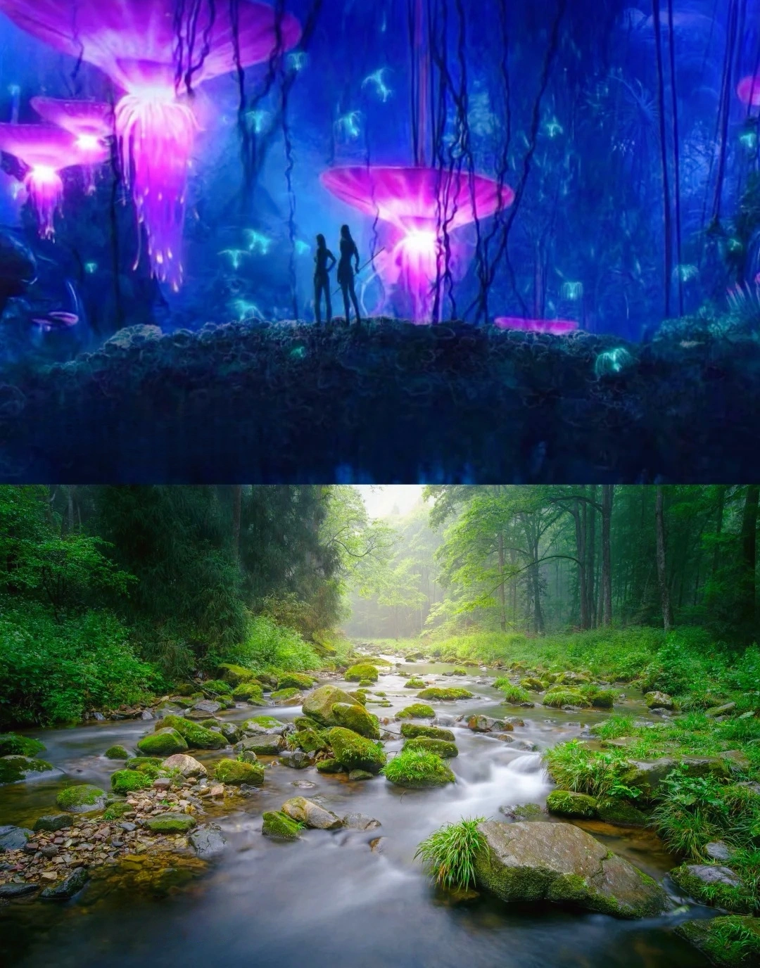
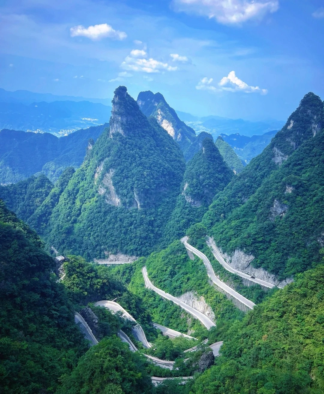
Our 2-day Zhangjiajie tour was beyond spectacular! As someone who’s visited Beijing and Shanghai for work, this trip revealed China’s wild, magical heart. Day 1 in Zhangjiajie National Forest Park felt like stepping onto Pandora—I’m a huge Avatar fan, and Yuanjiajie’s floating peaks left me breathless. The misty pillars and lush valleys like pure movie magic!
Then came Fenghuang Ancient Town, we eat dinner beside the thundering waterfall. It seems Unreal! The night views of stilt houses glowing over the river were straight from a fairy tale.
For fellow Avatar lovers and adventure seekers: Don’t miss this bucket-list experience! 10/10 would return.
A Well-Traveled Film Buff, May 2025
Destination(s):
Zhangjiajie
Date of
Experience:
May 08,2025